Friday, December 30, 2011

Las Vegas: Desert Running, The Las Vegas Running Scene

My second metatarsal on my right foot is still bothering me some, but my hip has improved greatly and I am no longer experiencing any pain or tightness in that area.  This was great news because the weather in Las Vegas was up to 65 degrees when I went out for my first longer run in a while on Wednesday evening.


I thought a flatter run might be best so I started running from Katie's parents house directly north into the Las Vegas desert between the Las Vegas Range of mountains and the Las Vegas Beltway.  This is completely barren and empty desert land that stretches for around eight miles between the beltway and the mountains and is part of the Desert National Wildlife Range.


It felt great to run for miles on neither trail or road, just barren desert with not a single audible sound to be heard.


Las Vegas Range

The city is miles away looking back

The terrain

The run quickly turned into a tempo run as I zig zagged a bit through the desert but kept a mostly straight path.  I occasionally spotted a tree or cactus of interest in the distance and diverted my path to head toward it and investigate.  It's simply shocking how far away an object in visual range can be out in the desert.


A strange desert find, a "phone tree"

A target apparently


On the way back I picked up the fast pace I had started and really stretched out my stride for a few miles.  I didn't recognize just how much elevation gain I had experienced running between the house and my turn around point in the desert.  When I got back I found out that I had run over 7 miles and climbed from 2000 to 2800 feet, and then turned around and ran 7 miles back with an 800 foot descent.


This type of running through an environment of vast scale is so different from home that I couldn't help but feel an ecstatic joy in pushing the pace into a tempo run.  A 7 mile downhill false flat is also a fun way to end any run.


I definitely in my time here can see how the varying conditions and terrain could be a paradise for many runners.  The highest runnable peak seen from the city is Mt. Charleston in the Spring Mountains at 11,916 feet.  It's worth also noting the proximity of Las Vegas to other great running destinations in the west including the Grand Canyon, Death Valley, Zion National Park, and Lake Tahoe.


I've visited the local running store, the Red Rock Company and found some great races, group runs, resources and evidences of a good local running and outdoor community here in Las Vegas.  Here a few links I found useful:
I also would guess that proximity to the Badwater 135 would be ideal for an ultra runner training for that race.  Las Vegas, while not an obvious selection, may be one to add to a list of great "running cities".

Thursday, December 29, 2011

Las Vegas: Gass Peak, Desert National Wildlife Refuge

From the windows facing north at the house of Katie's parents or from the backyard I can always see the Las Vegas Range of mountains off in the distance.  At the highest peak, the reflections from a solar panel installation create a faint but usually visible glimmer.  Anywhere  I go in North Las Vegas, the peak is ever present in my field of view.


Las Vegas Range: Gass Peak


In my own mind, this peak and mountain have become the windmill to my inner Don Quijote.  It is the eye of the great Sauron in my own epic tale.  I've tried to run toward it through the expanse of desert separating it from the city, but even then I knew that ultimately wouldn't be enough for satisfaction.


After a little planning, I talked to Katie and we decided that an adventure was needed.  We would drive in to the Desert National Wildlife Refuge and through the rocky desert roads to the so far unseen north side of Gass Peak and summit the mountain.  This would be a hike with as much running as possible as well.


I found a resource that was tremendously helpful in planning this trip.  A site called Bird and Hike has literally every area surrounding Las Vegas useful for hiking mapped, including a great guide to getting to the Desert National Wildlife Refuge and Gass Peak trail.


It took probably an hour and a half to drive to the trail.  It was easy to get to since we just had to drive north on Highway 95 until the turnoff for Desert National Wildlife Range Road.  This was a very rough and rocky road, and it was probably almost a requirement to drive an SUV or other vehicle with higher ground clearance.


Road at initial turn off


Entrance to refuge


We signed in at a check-in box, we were the only people to have signed in to the largest wildlife preserve in the lower 48 states that day.  Even after 16 or 17 miles of driving around on the rocky roads we never saw a single other person anywhere.  One person had signed in two days ago looking for pronghorns.  Hopefully they knew where to look because although we hoped to see a bighorn sheep or some other animal, we couldn't find any.  We did find animal droppings and paw/hoof prints in the snow on the mountain.

Sign In

Our directions to the trailhead worked out well and we arrived, prepared to make the ascent with a Nathan X-Ceed pack and REI Flash pack with 2 liters of water for each of us and gloves / long sleeved shirts packed for later.  Both are excellent to run or hike with due to their small size and light weight.

Katie at the trail head with Gass peak up above


We started off running and hiking, the road quickly got steeper as we ascended and then disappeared.  At that point the trail was a sometimes visible singletrack, otherwise we basically just climbed from ridge line to ridge line toward our always visible destination, Gass Peak.

Our starting elevation at the trailhead was 4910 feet, with Gass Peak being at 6,943 feet.  This ascent takes place over 3.14 miles, with steep climbs separated by moderate ridge lines.

Here are some photos from our ascent in chronological order.


The Car


The Car Again

The Car Yet Again


The Car is a Speck


Lake Mead behind Katie in the far south


We reached the summit after some more technical rock hopping and scrambling up some scree covered inclines.  We checked out the solar panels, weather station and also found a small rock structure at the summit with an ammo box inside containing a log book for us to sign.  The log book entries went back a few years, with someone else summiting a week or two ago.  There was a bottled water in the box so we decided to add a cliff bar to the mountain top treasure.  The views of Las Vegas, the wilderness range, Lake Mead, and Mt. Charleston were fantastic from up above.

Speck Car

Approximate Route

East

South

West

North

The descent was a blast, we hiked and mostly ran all the way to the bottom trailhead.  The thrill of running down steep rocky slopes was definitely worth the climb.  I ran a lot of downhill on the "edge" of control, sliding down snow, rocks and dirt several times.  Katie even attacked the downhills, albeit a little more wisely than myself.

Katie barreling downhill

Katie at the ridge top


After hanging around at the summit and running the downhills fast on the way back we ended up with a total time spent on the mountain of just under 4 hours.  Mileage is definitely relative as we probably covered around 6.3 miles in this time plus whatever mileage we added in going off the "offical" direct route.

Since we're used to running trails in dense forests, it is a bit of a shock to basically ignore the trails and just plot a ridge line trail any way one wants to a summit.  There's little fear of getting lost when it's possible to always look back at your entire line of ascent and retrace it with little difficulty.

It was a satisfying climb, especially because the mountain can be seen pretty much anywhere in the city.  Now we can look at it and think, "I climbed up that!".

We drove back to the city as the sun set and were treated to some beautifully colored skies over the mountains in the west.


Monday, December 26, 2011

Las Vegas: Upper Las Vegas Wash Regional Trail

Christmas is here, and that means our annual visit to my in-laws in sunny Las Vegas, Nevada.  We arrived on Saturday and will be staying until this coming Saturday so that hopefully means some warm weather running for both of us.  My hip is finally loosening up and my foot seems to be slightly improved.


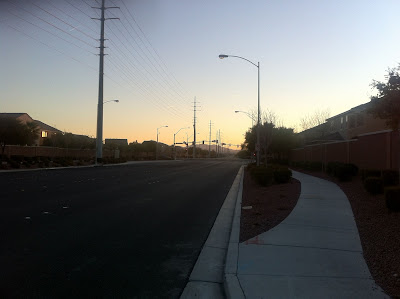
This morning just after sunrise (6:45 AM) I headed out the door to explore the Upper Las Vegas Wash Regional Trail.  This is a "trail" in the sense that the B-line in Bloomington is a "trail".  In other words, the "trail" is a long and flat paved path.  The winter temperatures in Las Vegas are absolutely perfect for running.  Sunny skies, low wind, and warm enough for shorts, long sleeves, and thin gloves in the early morning.  By the afternoon temperatures should be over 60 degrees.


Every Neighborhood

Looking west

Looking east

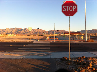
In North Las Vegas, it's important to remember street names.  This is because most every street has roughly the same view of the mountains, and looks almost exactly the same.  The first time I ran here I actually got lost.


Las Vegas is in a flat inclined "bowl" of sorts that allows for mostly unspoiled views of the surrounding mountains in every direction.  Nearly every street follows a straight line across the entire city and appears to end in mountain.


Looking north

After running about a half a mile on well maintained sidewalks past more identical stucco with clay roof housing developments I reached a deserted lot that offered an expansive view of the mountains to the north  adjacent to the rather large Upper Las Vegas Wash Channel where the "trail" actually begins.

North View of the Las Vegas Range

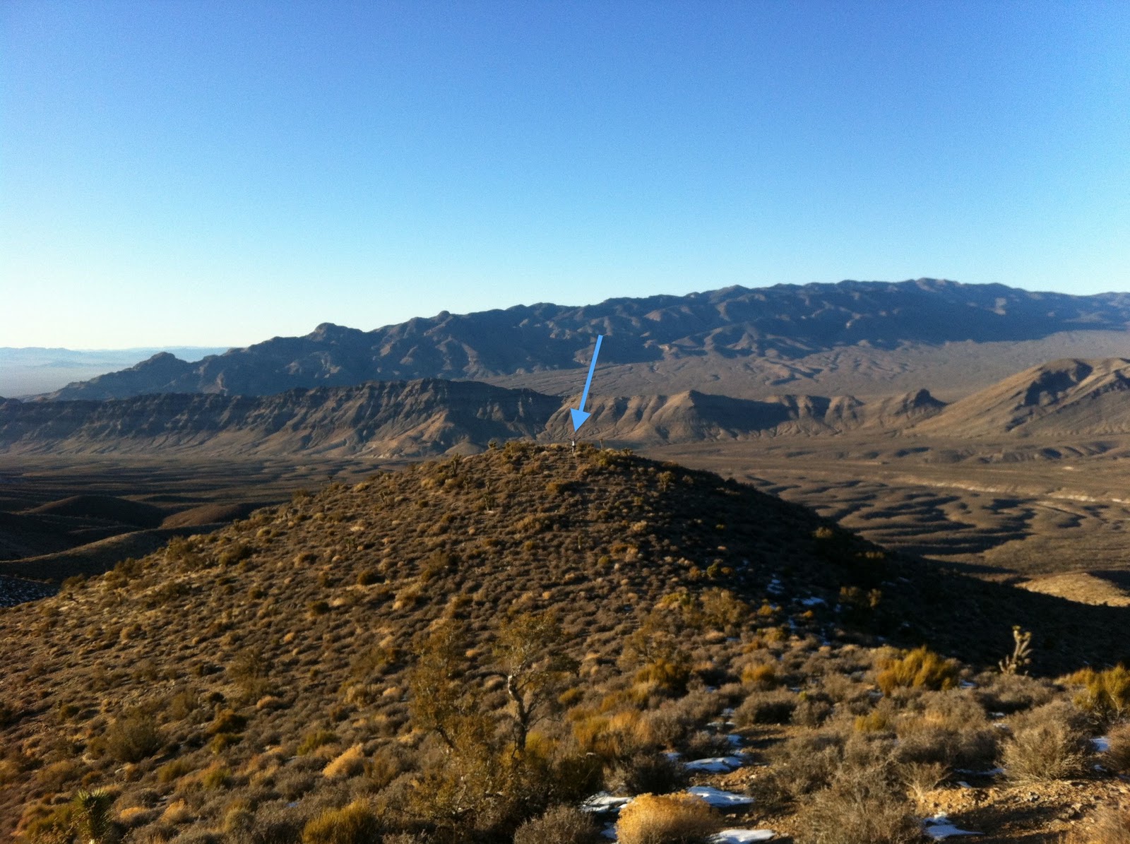
I'll admit that I am extremely drawn to this range of mountains to the North.  I've only once before run in the general direction of the mountains through the desert that stretches out under them.  Running straight from the Northern edge of Las Vegas to the mountains requires finding ways around some fences and a little trespassing, so I only on my final run last year in Las Vegas decided to try cutting through the desert there.  Over these mountains also lies the largest wildlife refuge in the lower 48 states, the Desert National Wildlife Refuge.

Wash Basin

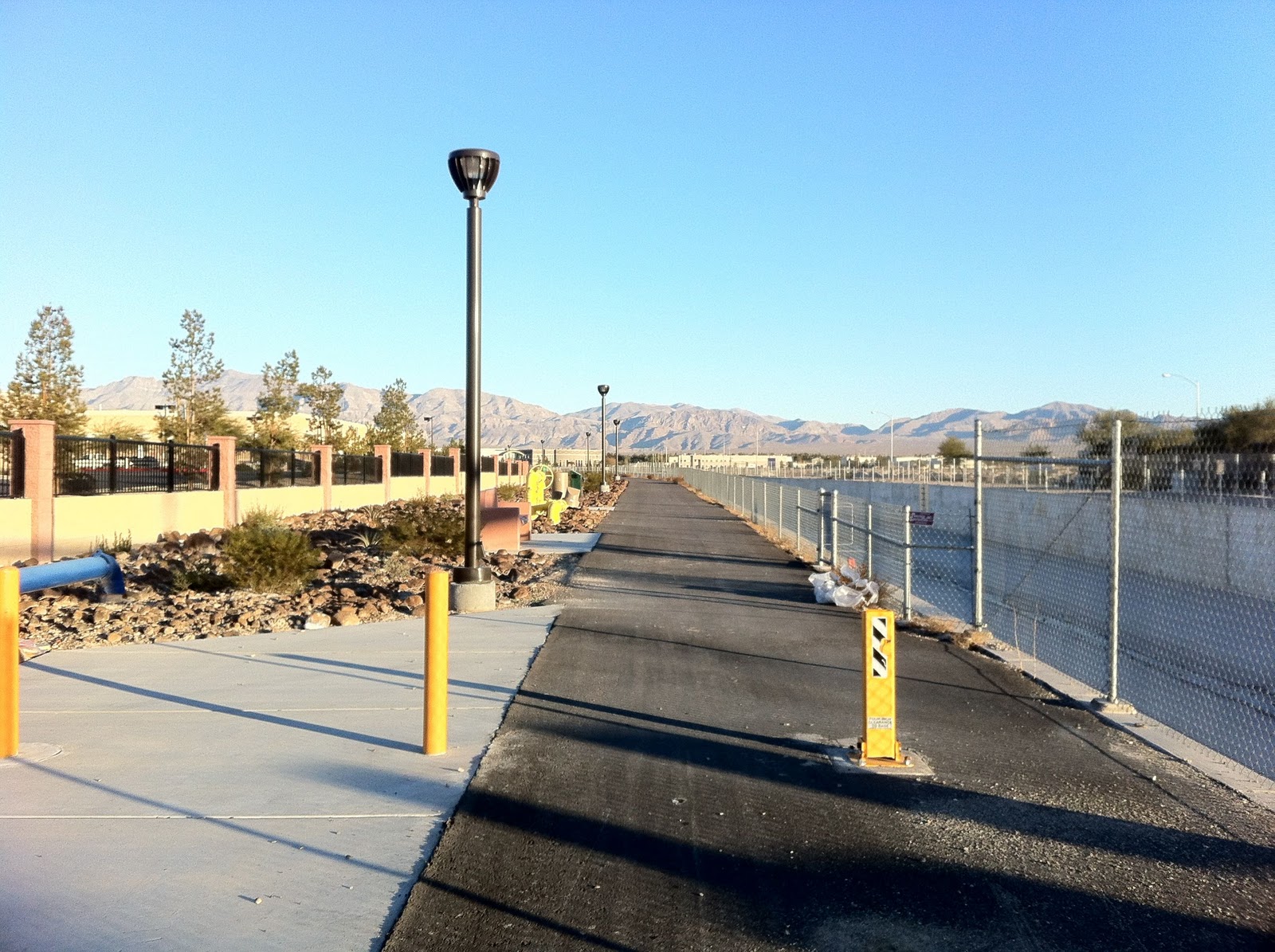
At this point I had reached a northern trailhead of the Upper Las Vegas Wash Regional Trail.  The path heads due south from this point and connects with another path coming from the west side of North Las Vegas.

Trail Start: dashed line means "under construction"

Trail Start

From this point on the paved path runs next to the wash channel and is flat and fast.  This was ideal in my case since this was my first real run in almost three weeks.  There are numerous bike racks, benches and picnic tables scattered along the path.  Despite being well maintained and entirely through residential areas I didn't actually see another person on the trail.  This isn't too surprising since I haven't seen many pedestrians in North Las Vegas either, despite the immaculately maintained sidewalks and densely dispersed housing.

Las Vegas strip off in the distance

Far off to the south, the Las Vegas strip was visible at most points on the path.  When the proposed master plan and trail system is complete, Las Vegas should have a multi use path that connects North Las Vegas to the strip and also to Red Rock Canyon to the west.  That seems pretty good for a sprawling city of this type.

After about a mile I reached a section of gravel with "no trespassing" signs that appeared to be the end of the trail.  However, this vacant gravel area was only about 200 meters long and after crossing through it I was able to pick up the paved path again.


Not the end of the path

At another point along the path I passed another vacant lot that offered a good view of the Spring Mountains to the west and was full of rocks and the type of desert plants one would expect.  This is typical of the vacant lots found around North Las Vegas.

The Spring Mountains and Mt. Charleston


I finally reached a point where it was clear (numerous fences and blockades attested to this) that the path wasn't accessible along the basin to travel any further south.  The "end" of the trail was actually perfect for a hungry runner as can be seen in the photo below.

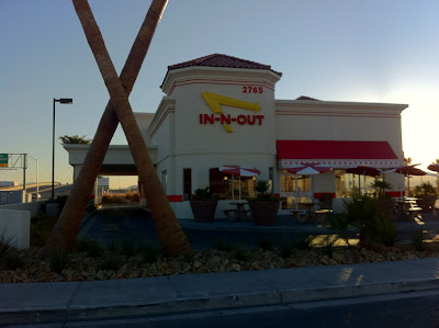
End of the Trail: The Southwest's Best

I will have to say that accessibility of an In-N-Out Burger along the path will definitely influence my rating of this trail.


After a turn around (and unfortunately no burger) I reached the current south "start" of the trail again, which although under construction does have a nice identifying sign.


Current "end" of the trail


I ran due north, and headed back along the same path.  The trip north was fast and had a satisfyingly consistent and picturesque view of the Las Vegas Range once again.


After exiting the trail and heading back to the house I had run close to 7 miles.  This was better than I expected for my first day back to running.  The temperature had risen ten degrees during the hour and I even got some good stretching in for my IT band and hip thanks to the numerous benches and tables along the route.  Also a little hip massage on the easy curve of the bike racks worked out well in the absence of my foam roller.  It feels good to be running again and out in the sunshine!